
|
作者/Author
戴榮冠 Dai Rong Guan
標題/Title
結合文史導覽與GIS工具的遠距教學實驗
The classroom teaching experiment of Three GIS tools collaboration |
 |
|
摘要/Summary
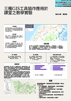
GIS地理資訊系統近年來廣泛應用於文學教學課程中,如QGIS、TGOS、ArcGis的蓬勃發展,使得教學有線上操作的平台支援。並且因圖檔、資訊具有「共享」特質,而使得「共同協作」變得更為簡便。然而,GIS雖然有「線上協作」的優勢,但是各種GIS軟體間有著各自的優點與侷限,如QGIS具備強大的圖層套疊、標記、計算能力,但卻缺乏線上導覽、同時協作的推廣功能。TGOS地圖協作平台具備圖層套疊、線上瀏覽、共同協作等功能,但缺乏圖層後製與計算的能力。要如何有效整合數位工具,讓GIS工具彼此能發揮互補作用,使GIS平台彼此間也能以圖檔進行「工具協作」,是本文所關注的焦點。本文以「文史脈流」、「QGIS」、「TGOS」三種地理資訊與導覽平台為研究工具,整合三項工具各自優點,以進行「工具協作」的實驗。教學現場的設定,以學校現場學習者為對象,實驗材料則以相同主題,引導學生針對主題各部分,使用三種工具進行「分工協作」,以檢視GIS工具學員協作的可能性。實驗步驟上,首先以「文史脈流」工具做為基礎學習鷹架,由於「文史脈流」已經具備基礎的詮釋資料(Metadata)架構,因此對於初入手GIS工具的學習者而言,能依照線上指引快速鍵入基礎資料,並進行景點(POI)、景線(LOI)、景區(AOI)的定位與繪製,省去了搜尋定位的麻煩。在「文史脈流」的製作基礎上,進一步引導學生以「QGIS」工具進行「圖層疊加」、「圖層標註」等加工教學,使圖層增添「資料標記」、「歷史脈絡」、「圖層對照」的功能。進一步,再由QGIS進行基礎詮釋資料(Metadata)的修改。文史脈流可提供CSV檔匯出,再以QGIS調整內容,由於文史脈流所提供的基礎詮釋資料內容架構,未必完全符合使用者需求,因此將文史脈流完成的基礎架構,再套入QGIS中進行加工,一來能訓練同學資料格式轉換能力,二來也可以在QGIS中訓練同學圖層套疊、圖層標註、基礎詮釋資料修改、圖層標記等出圖訓練。最後,課堂出圖以「可供線上瀏覽檢視」為目標,因此在QGIS修改圖層後,最後將圖檔匯出至TGOS地圖協作平台進行檢視,以確定圖層是否能滿足實用需求。透過本教學實驗,能落實三種文史導覽與GIS工具間的協作模組。教學現場也能導入不同平台間「格式轉換」、「資料補充」、「成果檢視與修正」的教學內容,藉此以檢視GIS數位平台間互補的可能性。 GIS geographic information system has been widely used in literature teaching courses in recent years. For example, the vigorous development of QGIS, TGOS, ArcGis has enabled the platform to support teaching operations on the cable. Because of the information can be shared,the Collaboration becomes easier.However, various GIS software has its own advantages and disadvantages. For example, QGIS has layer overlay and calculation capabilities, but it does not have the functions of online navigation and working together. TGOS has functions such as layer overlay, online browsing, and collaboration, but it lacks the ability to create and calculate layers.How to make GIS tools complement each other so that GIS tools can work together and engage in remote teaching is the focus of this study.In this study, the DEH, QGIS, and TGOS, are selected as the research objects to conduct joint experiments.The experiment is aimed at the students in the class.First of all, DEH is the basis. Since DEH already has basic Metadata, students can quickly input information and location of scenic spots.After DEH completes the content, export the CSV file and adjust the content with QGIS. Since the content provided by DEH may not meet the needs of users, the DEH infrastructure is inserted into QGIS for modification.Finally, export the image file to TGOS and check whether it is suitable for online navigation to confirm whether the layer can meet the practical needs.Through this experiment, the cooperation mode of three online tools can be proved its feasibility. |
|
會議內容 |
海報發表 |